July 26, Day 53: Today is our 2nd full day here in Watkins Glen and we have decided to drive over to Ithaca and visit my old alma mater, Cornell University. From there we are not sure but we will probably drive up the west coast of Cayuga Lake for a few miles or so before heading back to our campsite. Fortunately today the weather is perfect for everything including taking long range photographs of our favorite lake, Seneca Lake.
As we headed down into Montour Falls located just south of Watkins Glen, Kathy spotted a house that she said that she had always loved both because of its beauty and because of its great views of Seneca Lake (similar to the view in the photo above). We were surprised to find that Kathy's I-love-that-house was for sale. I found out later that they were asking only $270,000 for this 2,588 sf house plus several large red barns all on 5.82 acres all with a spectacular view. If I were not so old . . . . Anyway, if anyone is interested let me know. My real estate commission fee is very low.
Kathy and I have driven from Watkins Glen to Ithaca in the past as we used to attend Cornell football games each fall when we lived on Seneca. We never however, noticed that along the way there was an old historic covered bridge, The Newfield Covered Bridge, that was built back in 1853. This bridge is the oldest covered bridge in New York State that one can still drive across, and, we did. A first.
Down in Montour Falls there is, not surprisingly, a falls by the name of Montour Falls. Unfortunately due to the very dry weather they have been having in this area, there was not a lot of water falling off this 165 foot high cliff although even with the lower volume of water the view of the water and the cliff is quite spectacular. We did notice that despite the 30 Minute Parking sign out by the road, it was quite clear that the 100 plus year old car had undoubtedly been parked there more than 30 minutes. The area of Montour Falls was first settled by white-Europeans in 1788, so relatively speaking the old car is still fairly new.
Cornell University has grown enormously since I graduated back in 1964 and maybe this accounts for why the parking lots have almost disappeared on campus. We were able to take this photograph of my old fraternity house, Psi Upsilon, because the parking lot was almost empty but because of the lack of parking on the rest of the campus we decided not to tour the campus. That plus Cornell is built on the side of a hill and walking on campus was always all uphill or downhill. Hard work for us old alumni.
One of the favorite attractions on campus besides the deep gorges on both sides of the campus that fall down to Cayuga Lake, is the view of the small Beebe Lake. This lake was created by partially damming up one of the streams that runs down one of the gorges. The dam was original built to operate a small power generator. The area surrounding the lake is now a natural park with hiking trails. Such activities we largely ignored as students.
Perhaps my most interesting re-visit here in Ithaca was to the home that five of us rented during my senior year at Cornell. It was a total dump when we rented it 52 years ago, but its location between two golf courses (Ithaca Country Club and the Cornell University Golf Course) made it a choice location and it was eventually turned into a private home and renovated (considerably). We had a lot of great parties at this place as well as a dog that was not potty trained, but we never played golf.
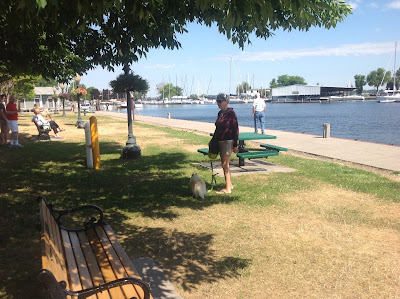
As we left Ithaca we stopped at a park located at the end of Cayuga Lake and I took this photo of Kathy and Cabo. Here again, a lovely lake with sailboats and deep blue water and tall tree covered hills dropping to the shoreline. Great spot to spend the summer.
Just up the western side of Cayuga Lake is a state park by the name of Taughannock Falls State Park. Here again is another deep gorge that was created by the rapidly running water flowing down into Cayuga Lake. The major attraction here of course, is the waterfall itself although considering the current drought conditions, the amount of water falling was far below normal.
There was one final stop that I knew we had to make despite the fact that it might cause me great emotional stress. The gravestone of my 3rd great grandfather Elijah Baker (1812-1876) we located in a cemetery behind the Presbyterian Church in the Village of Burdette where he had lived most of his life. Burdette is located above the southeastern shore of Seneca Lake not far from Watkins Glen. The smile on my face in this photo shows the great joy I felt finding the gravestone.
We returned to our campsite by around 2 o'clock. The rest of the afternoon I relaxed and wrote this blog while Kathy did the wash. Cabo just slept. Tomorrow we are headed south again with a planned stop just outside the City of Harrisburg, Pennsylvania.
Tuesday, July 26, 2016
Chapter 31 - Henderson to Watkins Glen, New York
July 24th, Day 51: This morning before we left we definitively made sure that Cabo was not alone in the car with our car keys. We did not want a repeat of yesterday. Anyway, our drive this morning was around three hours with most of it being on four-lane divided highways. By far the best part of the drive however,
was when we exited the New York Thruway at Geneva and then drove south along the western shoreline of Seneca Lake. The drive along the lake brought back memories of the five summers that we spent between 2004 and 2008 living in a cottage that we owned on Seneca Lake. This part of New York State is famous for its many vineyards and wineries and we passed dozens of them as we drove south. We also recalled that over these five summers that we spent here that we had tasted the wine in all of these wineries with the exception of one new one that we passed along the way. Hopefully we will sample their wine tomorrow. Our campground for the next three nights is a KOA. It is perhaps the nicest one we have visited so far on this trip and it is definitely the most expensive.
This photo to the right is pretty typical of the scenery here in the Finger Lakes. Acres and acres of grapevines growing down the hillsides surrounding the lakes. In the case of this photo, the lake is Seneca Lake, the largest of the Finger Lakes, about 38 miles long with a maximum width of only two miles. It is no wonder that they are called "finger" lakes.
As I previously mentioned, Kathy and I used to own a small cottage on Seneca Lake and while we know it has changed somewhat since we lived here, we still wanted to pay our old summer home a visit. The outside of the cottage really had not changed that much. The new owners changed the exterior paint colors and installed more modern windows, but one of the things that they did not change was the porch deck that I had personally constructed with my own hammer and saw and the porch furniture which we sold with the cottage back in 2008. The view of the cottage and the lake in front brought back a lot of pleasant memories.
Only a few miles from our old cottage is the small village of Dundee where a number of my ancestors had lived and had died and while I have visited their graves a number of times in the past, I figured that this blog would be lacking without including a few photographs of my weeping over their gravestones. In this first photograph I am standing next to the gravestone of my 4th great grandfather, Samuel Harpending (1778-1852). Great grandpa Sam and his wife Hannah Cozad were among the earliest settlers in this area.
This second photograph shows me kneeing in sorrow behind the gravestone of my 3rd great grandparents Charles S. Baker (1835-1891) and Hannah Elizabeth Harpending (1842-1891). In total I have five generations of my family buried in this small graveyard and my grandfather while not buried here, was born in Dundee. It is not surprising that this little town located between Seneca Lake on the east and Keuka Lake on the west is so important to our family.
It was after three in the afternoon before we returned to our campground. It was a long day considering our drive this morning hauling our travel trailer and then our touring this afternoon, but we enjoyed all of it. Our campsite was a very pleasant place to sit outside and enjoy the rest of the day and evening. Tomorrow we will tour some more.
July 25th, Day 52: We woke up this morning to nice cooler temperatures, which was good, but with skies that looked like it would rain any minute, which was not good. One of the locals mentioned to us when we noted the threatening skies, that the area badly needed rain both to water their lawns as well as the farmlands. All we questioned was the poor timing. Just hold off the rain until Wednesday afternoon, please. Our first visit this morning was to the mooring docks in Watkins Glen at the southern end of Seneca Lake. It was near here that our own boat was stored during the winter months and we thought that it would be fun to walk along the docks.
Obviously the skies were not cooperating and these two photographs reflect the gloominess of the morning.
Only minutes after we left the docks in Watkins Glen headed west to the lovely old village of Hammondsport at the southern end of Keuka Lake, the skies finally opened up and it rained hard for the next hour. The hard rain made driving on the hilly and winding roads very difficult and unpleasant but we were determined to keep moving and not let the rain spoil our day. Fortunately that rain let up shortly after arriving in Hammondsport which gave Kathy a chance to shop for a few souvenirs without getting wet and for us to drive around the village and bring back old memories.
Hammondsport was originally founded back in 1827 and one of the wonderful sights in the village besides the waterfront are the old and well preserved homes.
The Finger Lakes are noted for their vineyards therefore I could not help but take this photograph of one of my favorite fruits, the grape. And it is everywhere.
After leaving Hammondsport we headed up the west shoreline of Keuka Lake (now that it has stopped raining) with the good intentions of stopping at one of our favorite wineries, The Bully Hill Winery. We have tasted wine here, purchased wine, and had lunch here a number of times in the past and we have never been disappointed. Plus the view from the winery is fabulous. It was only around 12:30 pm when I had a few samples of their wine but as always their wine was delicious and I was forced (by human nature) to purchase a bottle.
This photo of Kathy and Cabo was taken from just below the Bully Hill Winery and it clearly shows why the Finger Lakes Region of New York State should be a destination for all travelers.
We left the winery traveling north up the west side of Keuka Lake. The scenery was beautiful as the highway made its way through the various small towns and past the numerous large vineyards and farmlands. We have had lunch several times at a great restaurant named the Esperanza located just south of the village of Penn Yan and we thought that it might be fun to stop by and check out their current menu. Cabo actually shared lunch with us out on their patio back in 2008. Unfortunately the restaurant was closed on Mondays but I took this photograph (above) of their building because it is such an impressive place and it has great views of Keuka Lake.
We continued north again passing through the village of Penn Yan before turning south and down a highway running between Seneca lake and Keuka Lake back to our new home town Watkins Glen and our campsite. It was almost 3 o'clock before we arrived "home". Shortly after our arrival at our campsite the skies opened up again and it started to rain. Now it did not matter. We were home. We sat under our awning listening to the rain and talked about what a great day we have had. We also talked about tomorrow for tomorrow we will again travel through this wonderful spot known as the Finger Lakes.
was when we exited the New York Thruway at Geneva and then drove south along the western shoreline of Seneca Lake. The drive along the lake brought back memories of the five summers that we spent between 2004 and 2008 living in a cottage that we owned on Seneca Lake. This part of New York State is famous for its many vineyards and wineries and we passed dozens of them as we drove south. We also recalled that over these five summers that we spent here that we had tasted the wine in all of these wineries with the exception of one new one that we passed along the way. Hopefully we will sample their wine tomorrow. Our campground for the next three nights is a KOA. It is perhaps the nicest one we have visited so far on this trip and it is definitely the most expensive.
This photo to the right is pretty typical of the scenery here in the Finger Lakes. Acres and acres of grapevines growing down the hillsides surrounding the lakes. In the case of this photo, the lake is Seneca Lake, the largest of the Finger Lakes, about 38 miles long with a maximum width of only two miles. It is no wonder that they are called "finger" lakes.
As I previously mentioned, Kathy and I used to own a small cottage on Seneca Lake and while we know it has changed somewhat since we lived here, we still wanted to pay our old summer home a visit. The outside of the cottage really had not changed that much. The new owners changed the exterior paint colors and installed more modern windows, but one of the things that they did not change was the porch deck that I had personally constructed with my own hammer and saw and the porch furniture which we sold with the cottage back in 2008. The view of the cottage and the lake in front brought back a lot of pleasant memories.
Only a few miles from our old cottage is the small village of Dundee where a number of my ancestors had lived and had died and while I have visited their graves a number of times in the past, I figured that this blog would be lacking without including a few photographs of my weeping over their gravestones. In this first photograph I am standing next to the gravestone of my 4th great grandfather, Samuel Harpending (1778-1852). Great grandpa Sam and his wife Hannah Cozad were among the earliest settlers in this area.
This second photograph shows me kneeing in sorrow behind the gravestone of my 3rd great grandparents Charles S. Baker (1835-1891) and Hannah Elizabeth Harpending (1842-1891). In total I have five generations of my family buried in this small graveyard and my grandfather while not buried here, was born in Dundee. It is not surprising that this little town located between Seneca Lake on the east and Keuka Lake on the west is so important to our family.
It was after three in the afternoon before we returned to our campground. It was a long day considering our drive this morning hauling our travel trailer and then our touring this afternoon, but we enjoyed all of it. Our campsite was a very pleasant place to sit outside and enjoy the rest of the day and evening. Tomorrow we will tour some more.
July 25th, Day 52: We woke up this morning to nice cooler temperatures, which was good, but with skies that looked like it would rain any minute, which was not good. One of the locals mentioned to us when we noted the threatening skies, that the area badly needed rain both to water their lawns as well as the farmlands. All we questioned was the poor timing. Just hold off the rain until Wednesday afternoon, please. Our first visit this morning was to the mooring docks in Watkins Glen at the southern end of Seneca Lake. It was near here that our own boat was stored during the winter months and we thought that it would be fun to walk along the docks.
Obviously the skies were not cooperating and these two photographs reflect the gloominess of the morning.
Only minutes after we left the docks in Watkins Glen headed west to the lovely old village of Hammondsport at the southern end of Keuka Lake, the skies finally opened up and it rained hard for the next hour. The hard rain made driving on the hilly and winding roads very difficult and unpleasant but we were determined to keep moving and not let the rain spoil our day. Fortunately that rain let up shortly after arriving in Hammondsport which gave Kathy a chance to shop for a few souvenirs without getting wet and for us to drive around the village and bring back old memories.
Hammondsport was originally founded back in 1827 and one of the wonderful sights in the village besides the waterfront are the old and well preserved homes.
The Finger Lakes are noted for their vineyards therefore I could not help but take this photograph of one of my favorite fruits, the grape. And it is everywhere.
After leaving Hammondsport we headed up the west shoreline of Keuka Lake (now that it has stopped raining) with the good intentions of stopping at one of our favorite wineries, The Bully Hill Winery. We have tasted wine here, purchased wine, and had lunch here a number of times in the past and we have never been disappointed. Plus the view from the winery is fabulous. It was only around 12:30 pm when I had a few samples of their wine but as always their wine was delicious and I was forced (by human nature) to purchase a bottle.
This photo of Kathy and Cabo was taken from just below the Bully Hill Winery and it clearly shows why the Finger Lakes Region of New York State should be a destination for all travelers.
We left the winery traveling north up the west side of Keuka Lake. The scenery was beautiful as the highway made its way through the various small towns and past the numerous large vineyards and farmlands. We have had lunch several times at a great restaurant named the Esperanza located just south of the village of Penn Yan and we thought that it might be fun to stop by and check out their current menu. Cabo actually shared lunch with us out on their patio back in 2008. Unfortunately the restaurant was closed on Mondays but I took this photograph (above) of their building because it is such an impressive place and it has great views of Keuka Lake.
We continued north again passing through the village of Penn Yan before turning south and down a highway running between Seneca lake and Keuka Lake back to our new home town Watkins Glen and our campsite. It was almost 3 o'clock before we arrived "home". Shortly after our arrival at our campsite the skies opened up again and it started to rain. Now it did not matter. We were home. We sat under our awning listening to the rain and talked about what a great day we have had. We also talked about tomorrow for tomorrow we will again travel through this wonderful spot known as the Finger Lakes.
Sunday, July 24, 2016
Chapter 30 - Montreal to Association Island, Henderson, New York
July 22, Day 56: We woke up early again this morning and I immediately discovered that the WiFi system in our campground was totally non-functional. Were the Canadians deliberately trying to prevent me from reading about Donald Trump's speech online in the Wall Street Journal? Anyway, with no way to waste time we found ourselves ready to head south by 7:00 am, a new record. The trailer was all hooked up, Cabo was placed in the car, and Kathy and I were doing one more final check before jumping in the car. When we returned to the car we discovered that Cabo had stood up to look out the car window and in doing so, he stepped on the door lock button and locked himself in the car along with both of our car keys. After a few failed efforts to try and get Cabo to step on the unlock button, we were forced to call CAA (Canadian Automobile Association) and one hour later and $75 poorer, we were finally ready to takeoff. Not a great way to start the day.
Our original plans were to spend a few nights at a campground somewhere in the 1000 Islands area on the New York side preferably. Unfortunately this being a July weekend with good weather projected, all of the campgrounds in both countries that we contacted were full. We ended up booking a KOA campground at an interesting location out on an island in Lake Ontario, but its location was considerably below the 1000 Islands area and a 4-1/2 hour drive from Montreal. Here again the drive was mostly on the Trans-Canada Highway with views of flat farmlands. The only really spectacular views occurred while crossing the bridge over the St. Lawrence River into the USA and they lasted but seconds and no photos could be taken.
The island on which sits our campsite is 65 acres and it is totally occupied by the KOA. The view of the island above was taken from the mainland near Henderson Harbor at a distance of at least a mile. The island has been named Association Island after the National Electric Light Association which owned the island for many years beginning in 1905. The campground is quite unusual considering how many sites (not ours unfortunately) sit right at the waters edge. One negative about the campground however, is that it can be quite windy as it sits right out in Lake Ontario and the numerous geese and sea gulls on the island have left their droppings everywhere including on the tops of the picnic tables. We spent most of the afternoon sitting outside our travel trailer enjoying the surroundings plus we did take the occasional walk around the island and took a few photographs.
This photo to the left shows the approach view to Association Island from the small 1-1/2 lane road leading over to the island.

This photograph of Kathy and Cabo was taken shortly after our arrival and it shows to some degree just how windy we found our first day out on the island. The temperatures were in the high 80s so the rather high winds were a welcome relief. As the photo of our campsite shows at the beginning of this chapter, the winds prevented us from putting down our awning.
Kathy and I walked around the island with Cabo (Kathy more than I) and on one occasion we ran into a young girl who was walking her young Pomeranian dog who could have been Cabo's younger sister.
While most of the shoreline around the island was loaded with RVs and trailers, there was a small park-like area that ran along the water that was quiet, peaceful, and covered with shade trees. It was in this area where we ran into Cabo's younger sister and it was in this area where this photo to the right was taken of Kathy and Cabo.
Other than leaving our trailer and our new home for a short while to purchase some needed supplies including propane, we spent the rest of the day relaxing around our trailer. One thing that I did spend some time researching was what and where we were going to spend time traveling tomorrow morning. While both Kathy and I have been to the Adirondacks Mountains in Northern New York and we have spent time in the Lake George area of New York State, we have never visited or even discussed what we would see and do on the eastern edge of Lake Ontario. We finally both agreed that we would simply drive up along the coastline and see what we might find.
July 23rd, Day 57: Kathy got up early this morning and disappeared for awhile and came back reporting that she had watched the sunrise and taken a few photos. As this one photo shows Kathy was not alone outside before 6 am watching the sun come up. Some children were wading in the water and some adults were simply sitting in their folding chairs watching the sun come up. Sunrises and sunsets are a big attraction on this island.
Shortly before 8 am we headed off the island and once we reached Hwy 3 we turned left and headed north. According to my AAA website, Hwy 3 is rated as a scenic highway and we have to agree with them as we drove northward. Our first stop along the way was in the small hamlet of Henderson Harbor which not surprisingly sat right on the shoreline of Henderson Bay.
The views of the bay were lovely but so were the many homes that sat along its shoreline. As we always do Kathy and I joked about which ones we wanted to purchase, although honestly the quality of the many homes that we passed along the coastline would suggest that they probably cost far more than we might be willing to pay.
Our next major stop heading north was in the Village of Sackets Harbor. Sackets Harbor was a very pleasant surprise for us not only because their main street was a collection of 19th century well preserved buildings that sat right along the shoreline of Sacket Harbor, but also because we soon learned that the original village was a major shipyard during the War of 1812. Because of the shipyard and its importance during the war, the American military constructed a fort in the village to defend the area if necessary against a possible attack from the British. We further read that the area of Sacket Harbor by the year 1814 was the third most populated area in the State of New York after Albany and New York City. Go figure, and we arrived here in this historic little village simply by chance.
Certainly one of the most frequently visited sites in Sackets Harbor besides all of the shops, the restaurants, and the harbor is the Sackets Harbor Battlefield State Historic Site. Unfortunately, besides a few old homes turned into museums, some monuments, and characters dressed in various period costumes, the battlefield site was not that interesting.
We were also a little confused as to why some of the solders dressed in period costumes wore the uniforms of Civil War soldiers. It seems that this site was also used as a training center during the Civil War.
There were quite a number of outdoor restaurants in old Sackets Harbor both lining the Main Street as well as facing the harbor, but the restaurant shown in this photograph to the right was not only the most crowded but also had a long line of folks waiting to be seated.
Another attractive restaurant in this obviously popular city (at least during the warmer summer months) was this restaurant shown in the photograph to the left where the patrons had views of the harbor. We could nor understand why this restaurant had plenty of seats available.
For Kathy and I the best part of visiting this old city was just walking up and down the streets and looking at the older homes. Where we live in Florida an old home is one that was built in the early 1900s and there are very few of them. Walking down the Main Street in Sackets Harbor it is doubtful that any of the homes were built after the 1900s with many of them built in the early to mid-1800s.
This one old building shown in this photograph to the left currently houses a museum that unfortunately we did not visit because dogs were not allowed indoors. I suspect however, that had we visited the museum we would know far about this old village. I suspect that most citizens in our country have never heard of Sackets Harbor. Kathy and I are now not among that group.
We returned back to our campsite by early afternoon content once again to just relax. Tomorrow our plan is to drive south in New York State down into the well known Finger Lakes region where we plan to spend the next three nights
Our original plans were to spend a few nights at a campground somewhere in the 1000 Islands area on the New York side preferably. Unfortunately this being a July weekend with good weather projected, all of the campgrounds in both countries that we contacted were full. We ended up booking a KOA campground at an interesting location out on an island in Lake Ontario, but its location was considerably below the 1000 Islands area and a 4-1/2 hour drive from Montreal. Here again the drive was mostly on the Trans-Canada Highway with views of flat farmlands. The only really spectacular views occurred while crossing the bridge over the St. Lawrence River into the USA and they lasted but seconds and no photos could be taken.
The island on which sits our campsite is 65 acres and it is totally occupied by the KOA. The view of the island above was taken from the mainland near Henderson Harbor at a distance of at least a mile. The island has been named Association Island after the National Electric Light Association which owned the island for many years beginning in 1905. The campground is quite unusual considering how many sites (not ours unfortunately) sit right at the waters edge. One negative about the campground however, is that it can be quite windy as it sits right out in Lake Ontario and the numerous geese and sea gulls on the island have left their droppings everywhere including on the tops of the picnic tables. We spent most of the afternoon sitting outside our travel trailer enjoying the surroundings plus we did take the occasional walk around the island and took a few photographs.
This photo to the left shows the approach view to Association Island from the small 1-1/2 lane road leading over to the island.
This photograph of Kathy and Cabo was taken shortly after our arrival and it shows to some degree just how windy we found our first day out on the island. The temperatures were in the high 80s so the rather high winds were a welcome relief. As the photo of our campsite shows at the beginning of this chapter, the winds prevented us from putting down our awning.
Kathy and I walked around the island with Cabo (Kathy more than I) and on one occasion we ran into a young girl who was walking her young Pomeranian dog who could have been Cabo's younger sister.
While most of the shoreline around the island was loaded with RVs and trailers, there was a small park-like area that ran along the water that was quiet, peaceful, and covered with shade trees. It was in this area where we ran into Cabo's younger sister and it was in this area where this photo to the right was taken of Kathy and Cabo.
Other than leaving our trailer and our new home for a short while to purchase some needed supplies including propane, we spent the rest of the day relaxing around our trailer. One thing that I did spend some time researching was what and where we were going to spend time traveling tomorrow morning. While both Kathy and I have been to the Adirondacks Mountains in Northern New York and we have spent time in the Lake George area of New York State, we have never visited or even discussed what we would see and do on the eastern edge of Lake Ontario. We finally both agreed that we would simply drive up along the coastline and see what we might find.
July 23rd, Day 57: Kathy got up early this morning and disappeared for awhile and came back reporting that she had watched the sunrise and taken a few photos. As this one photo shows Kathy was not alone outside before 6 am watching the sun come up. Some children were wading in the water and some adults were simply sitting in their folding chairs watching the sun come up. Sunrises and sunsets are a big attraction on this island.
Shortly before 8 am we headed off the island and once we reached Hwy 3 we turned left and headed north. According to my AAA website, Hwy 3 is rated as a scenic highway and we have to agree with them as we drove northward. Our first stop along the way was in the small hamlet of Henderson Harbor which not surprisingly sat right on the shoreline of Henderson Bay.
The views of the bay were lovely but so were the many homes that sat along its shoreline. As we always do Kathy and I joked about which ones we wanted to purchase, although honestly the quality of the many homes that we passed along the coastline would suggest that they probably cost far more than we might be willing to pay.
Our next major stop heading north was in the Village of Sackets Harbor. Sackets Harbor was a very pleasant surprise for us not only because their main street was a collection of 19th century well preserved buildings that sat right along the shoreline of Sacket Harbor, but also because we soon learned that the original village was a major shipyard during the War of 1812. Because of the shipyard and its importance during the war, the American military constructed a fort in the village to defend the area if necessary against a possible attack from the British. We further read that the area of Sacket Harbor by the year 1814 was the third most populated area in the State of New York after Albany and New York City. Go figure, and we arrived here in this historic little village simply by chance.
Certainly one of the most frequently visited sites in Sackets Harbor besides all of the shops, the restaurants, and the harbor is the Sackets Harbor Battlefield State Historic Site. Unfortunately, besides a few old homes turned into museums, some monuments, and characters dressed in various period costumes, the battlefield site was not that interesting.
We were also a little confused as to why some of the solders dressed in period costumes wore the uniforms of Civil War soldiers. It seems that this site was also used as a training center during the Civil War.
There were quite a number of outdoor restaurants in old Sackets Harbor both lining the Main Street as well as facing the harbor, but the restaurant shown in this photograph to the right was not only the most crowded but also had a long line of folks waiting to be seated.
Another attractive restaurant in this obviously popular city (at least during the warmer summer months) was this restaurant shown in the photograph to the left where the patrons had views of the harbor. We could nor understand why this restaurant had plenty of seats available.
For Kathy and I the best part of visiting this old city was just walking up and down the streets and looking at the older homes. Where we live in Florida an old home is one that was built in the early 1900s and there are very few of them. Walking down the Main Street in Sackets Harbor it is doubtful that any of the homes were built after the 1900s with many of them built in the early to mid-1800s.
This one old building shown in this photograph to the left currently houses a museum that unfortunately we did not visit because dogs were not allowed indoors. I suspect however, that had we visited the museum we would know far about this old village. I suspect that most citizens in our country have never heard of Sackets Harbor. Kathy and I are now not among that group.
We returned back to our campsite by early afternoon content once again to just relax. Tomorrow our plan is to drive south in New York State down into the well known Finger Lakes region where we plan to spend the next three nights
Thursday, July 21, 2016
Chapter 29 - Quebec City to Montreal
July 20th, Day 54: Today we drove the mostly straight, mostly flat Trans-Canada highway southwest from Quebec City to a KOA campground located just outside the City of Montreal. The drive took us around three hours. Our views were of pretty farmlands but nothing really special, especially when comparing it with our recent travels through the Maritime Provinces. We talked during the drive about our recent visit to Old Quebec City and how we both agreed that probably nowhere during our drive back to Florida would we see anything that could match such an experience. Perhaps this feeling is why we only booked two nights in Montreal. Has the best come and gone? Since it was just past noon before we were all hooked up at our new campsite, it was agreed that we would not drive into Montreal until tomorrow morning.
Our campsite was really quite nice (they even had their own Eiffel Tower) and we had some shopping to do and taking the afternoon off from being tourists was not a bad idea even thought it meant that we were allocating only one day to visit Canada's second largest city and like Quebec City, one of its oldest. We justified this short visit to this beautiful city by recalling that we had briefly visited Montreal back in 2004. It is possible however, that our real reason may be that we just needed to slow down a bit. Today is after all, our 54th day on the road. It was warm and sunny and we enjoyed the afternoon and early evening relaxing under our awning. We went to bed fairly early.
July 21, Day 55: Despite the possibility that we might run into heavy traffic driving into Montreal just before 8 am, we did it anyway. We ran into heavy traffic just before crossing the bridge over the St. Lawrence River into Montreal and it was stop and go for the next half hour before we finally found our parking ramp. Our underground parking ramp was under or adjacent (hard to tell) to the beautiful Hotel de Saint-James (shown in the photo) and before we could even find a parking space we found ourselves seven floors below street level, which I figured was at least 80 to 90 feet underground. No wonder tourists take tour buses into big cities. We had to walk up to the street since we did not recognize that the sign stating "Ascenseur" was directing us to the elevator. Dumb Americans. No wonder that my knee was hurting later in the morning.
Our parking ramp fortunately was located close to most of the major attractions in what is known as Old Montreal. Like Quebec, Montreal is a very old city originally founded by the French in 1642. The old part of the city also like Quebec, was originally surrounded by stone fortress walls although beginning in the year 1804 they started removing the stone walls which today are entirely gone.
Our first stop of the day and perhaps even the highlight of our visit to Montreal, was a visit to the famous Notre-Dame Basilica of Montreal. Construction of this church masterpiece began in 1824.
It is the interior of the church that is perhaps the reason that hundreds of thousands of visitors are willing to pay a compulsory donation of $5.00 to enter the church interior. It was well worth the donation. Kathy and I both toured the interior of the church, separately of course, since Cabo was denied entry. This is only one of the many photographs that were taken inside this awesome structure. Many years ago Kathy and I visited St. Peter's Basilica at the Vatican in Rome and while it was many times larger, we do not recall it's interior as having such a colorful and inspiring appearance as in the Notre-Dame Basilica.
The plaza out in front of the church contained a statute of the founder of Montreal, a man by the name of Paul de Chomedey. The statue was set in place in the year 1895.
Across the plaza from the Notre-Dame Basilica was another old building that houses the Bank of Montreal. The building was originally built back in 1847. The Bank of Montreal is said to be the oldest bank in Canada. Now this is where you want to go if you want to borrow (Canadian) money.
Our next visit only a few blocks away was to another even larger plaza known as Place Jacques-Cartier. This plaza often offers a spot for local artists to sell their crafts although today there were few artists present probably because it was a workday and they need regular jobs to earn money. The plaza was lined with lovely outdoor restaurants.
At the upper end of the plaza was Montreal's old city hall constructed back between 1872 and 1878. One of the very special things that separates the beauty of Old Quebec City and the beauty of Old Montreal, is that here in Montreal many of their old buildings are huge. This size differential allows us not to want to compare these two cities. They are both wonderful places to visit and frankly both are so much more beautiful than any of our older cities in the United States. The American talent of tearing down and building new is not always a positive attribute.
At this point Kathy and I had walked at least a mile (Cabo maybe 10 feet) and my poor knee was starting to hurt, so we decided to head back to our car. On the way back we walked along the waterfront and while there were huge docks, it appeared that all of the ships including the frequent visiting cruise liners were not in port. This photo to the left which was taken along the Rue de la Commune which runs along the waterfront, shows buildings that were also built in the mid-1800s. Preservation is the key.
On our return walk we followed some back streets which were suggested by our tourist guide book. It seemed that once we got off the larger streets and on to more narrow one-way streets the quality of the stores improved. Less tourist junk. This would seem to be contradictory to logic but we noticed the same thing was happening in Old Quebec City.
On our return walk we sat down frequently but fortunately, Old Montreal gave us lots of opportunities to just sit back and enjoy the scenery. We were also in no hurry to leave Old Montreal because we knew that what faced us in the near future was another horrible traffic jam getting out of the city.
As we neared our parking ramp we again passed the Notre-Dame Basilica but this time approaching it from the rear. We had to take one final photograph of this wonderful structure.
We left Montreal in the early afternoon in a traffic nightmare as expected. All of the road construction going on everywhere also did not help as our poor Garmin GPS was horribly confused. We returned however to our campground very pleased with our visit to Montreal. We know that we missed a lot of sights here in this city but when you are traveling like we do, we need to expect that we just do not have the time to become experts on every place that we visit.
Tomorrow we are headed back through the 1000 Islands area of the St. Lawrence River and back into the United States. It occurred to Kathy that we still had around $40 Canadian money in our possession, so, knowing that it would be foolish to return to the US with Canadian money, she decided to . . . .
.
Our campsite was really quite nice (they even had their own Eiffel Tower) and we had some shopping to do and taking the afternoon off from being tourists was not a bad idea even thought it meant that we were allocating only one day to visit Canada's second largest city and like Quebec City, one of its oldest. We justified this short visit to this beautiful city by recalling that we had briefly visited Montreal back in 2004. It is possible however, that our real reason may be that we just needed to slow down a bit. Today is after all, our 54th day on the road. It was warm and sunny and we enjoyed the afternoon and early evening relaxing under our awning. We went to bed fairly early.
July 21, Day 55: Despite the possibility that we might run into heavy traffic driving into Montreal just before 8 am, we did it anyway. We ran into heavy traffic just before crossing the bridge over the St. Lawrence River into Montreal and it was stop and go for the next half hour before we finally found our parking ramp. Our underground parking ramp was under or adjacent (hard to tell) to the beautiful Hotel de Saint-James (shown in the photo) and before we could even find a parking space we found ourselves seven floors below street level, which I figured was at least 80 to 90 feet underground. No wonder tourists take tour buses into big cities. We had to walk up to the street since we did not recognize that the sign stating "Ascenseur" was directing us to the elevator. Dumb Americans. No wonder that my knee was hurting later in the morning.
Our parking ramp fortunately was located close to most of the major attractions in what is known as Old Montreal. Like Quebec, Montreal is a very old city originally founded by the French in 1642. The old part of the city also like Quebec, was originally surrounded by stone fortress walls although beginning in the year 1804 they started removing the stone walls which today are entirely gone.
Our first stop of the day and perhaps even the highlight of our visit to Montreal, was a visit to the famous Notre-Dame Basilica of Montreal. Construction of this church masterpiece began in 1824.
It is the interior of the church that is perhaps the reason that hundreds of thousands of visitors are willing to pay a compulsory donation of $5.00 to enter the church interior. It was well worth the donation. Kathy and I both toured the interior of the church, separately of course, since Cabo was denied entry. This is only one of the many photographs that were taken inside this awesome structure. Many years ago Kathy and I visited St. Peter's Basilica at the Vatican in Rome and while it was many times larger, we do not recall it's interior as having such a colorful and inspiring appearance as in the Notre-Dame Basilica.
The plaza out in front of the church contained a statute of the founder of Montreal, a man by the name of Paul de Chomedey. The statue was set in place in the year 1895.
Across the plaza from the Notre-Dame Basilica was another old building that houses the Bank of Montreal. The building was originally built back in 1847. The Bank of Montreal is said to be the oldest bank in Canada. Now this is where you want to go if you want to borrow (Canadian) money.
Our next visit only a few blocks away was to another even larger plaza known as Place Jacques-Cartier. This plaza often offers a spot for local artists to sell their crafts although today there were few artists present probably because it was a workday and they need regular jobs to earn money. The plaza was lined with lovely outdoor restaurants.
At the upper end of the plaza was Montreal's old city hall constructed back between 1872 and 1878. One of the very special things that separates the beauty of Old Quebec City and the beauty of Old Montreal, is that here in Montreal many of their old buildings are huge. This size differential allows us not to want to compare these two cities. They are both wonderful places to visit and frankly both are so much more beautiful than any of our older cities in the United States. The American talent of tearing down and building new is not always a positive attribute.
At this point Kathy and I had walked at least a mile (Cabo maybe 10 feet) and my poor knee was starting to hurt, so we decided to head back to our car. On the way back we walked along the waterfront and while there were huge docks, it appeared that all of the ships including the frequent visiting cruise liners were not in port. This photo to the left which was taken along the Rue de la Commune which runs along the waterfront, shows buildings that were also built in the mid-1800s. Preservation is the key.
On our return walk we followed some back streets which were suggested by our tourist guide book. It seemed that once we got off the larger streets and on to more narrow one-way streets the quality of the stores improved. Less tourist junk. This would seem to be contradictory to logic but we noticed the same thing was happening in Old Quebec City.
On our return walk we sat down frequently but fortunately, Old Montreal gave us lots of opportunities to just sit back and enjoy the scenery. We were also in no hurry to leave Old Montreal because we knew that what faced us in the near future was another horrible traffic jam getting out of the city.
As we neared our parking ramp we again passed the Notre-Dame Basilica but this time approaching it from the rear. We had to take one final photograph of this wonderful structure.
We left Montreal in the early afternoon in a traffic nightmare as expected. All of the road construction going on everywhere also did not help as our poor Garmin GPS was horribly confused. We returned however to our campground very pleased with our visit to Montreal. We know that we missed a lot of sights here in this city but when you are traveling like we do, we need to expect that we just do not have the time to become experts on every place that we visit.
Tomorrow we are headed back through the 1000 Islands area of the St. Lawrence River and back into the United States. It occurred to Kathy that we still had around $40 Canadian money in our possession, so, knowing that it would be foolish to return to the US with Canadian money, she decided to . . . .
.
Subscribe to:
Posts (Atom)


